Dam Survey
Knowing the water carrying capacity is vital for farmers. This is why many farmers get their dams surveyed.
Traditionally surveyors will go around on foot or in a vehicle measuring the general changes across the dam surface, such as the crest, toe and heal. A measurement will be taken every 10m or so, however a lot of variation can occure between these points. Up until now these results have been good enough.
Using the latest technology and understanding farmers needs, InFarm and its partners have developed a new system, providing farmers with more accurate, faster and cheaper dam surveying results.
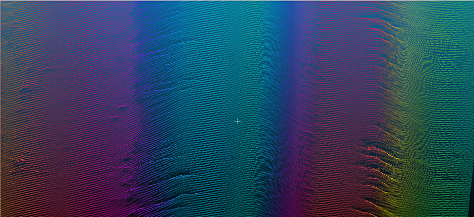
- How accurate is it? The analysis is very accurate. In fact it is so accurate we can see and measure erosion on Dam banks. See the image below.
- What do I get? 1. Dam Capacity Measurement. 2. File for remote dam monitoring systems. 3. High definition map of the dam, which can be used to track erosion. 4. A file that is useful for Dam earthwork planning.
- Does this work with Dam monitoring System? Yes Dam monitoring systems, such as Goanna Telemetry Dam Monitoring System, need our survey to provide you with accurate water levels and capacity.
- How much does it cost? It depends on the size of your dam.
Please contact us so we can give you a quote.